GLORIA network (Global Observation Research Initiative in Alpine Environments)
The GLORIA program is an international long term observation network of permanent vegetation plots in mountain ecosystems. Itassesses and predicts losses of biodiversity, and vulnerability of high mountain ecosystems under the effect of climate change.
Funding: CONICET, FONCYT, ALARM (Assessing Large Scale RIsks for Biodiversity with tested methods), COSUDE (Swiss Agency), CONDESAN (Consorcio para el desarrollo sostenible de los Andes), NSG (National Geographic Society).
Starting date: 2006
Responsible researchers:
Julieta Carilla, Alfredo Grau.
Instituto de Ecología Regional (IER), UNT - CONICET
Soledad Cuello.
Instituto de Bioprospección y Fisiología Vegetal (INBIOFIV), CONICET
Abstract:
The GLORIA program is a long term international network of permanent vegetation plots on mountain ecosystems at a global scale. Its main objective is to identify and quantify the risks of biodiversity losses and vulnerability of high mountain ecosystems under the effect of climate change. Each GLORIA pilot site encompasses four summits distributed along an elevation gradient, all situated above the treeline. The summit area is considered up to the 10 m contour line from the highest point and is monitored following the multi summit approach criteria.
The GLORIA international network emerged at the end of the 1990s (Austrian Academy of Sciences). Nowadays, it comprises ca. 150 sites situated on mountains on six continents. In 2008, the GLORIA Andes network was created to promote the comparative study of the impacts of climate change on high mountain biodiversity in the Andean region, through a long-term regional monitoring system. Currently the project covers ca. 20 sites, distributed from Argentina to Venezuela.
The specific objectives of the GLORIA network are: 1) Monitor and document the impact of climate change on mountain biodiversity, so that real risks and adaptation strategies can be established, using quantifiable, standardized data on richness, composition and plant cover/abundance, and habitat characteristics. 2) Quantify trends in diversity, composition, and abundance of species and temperature through long-term monitoring of permanent plots measured every 5-10 years. In particular, the GLORIA Andes network has the following objectives: 1) Facilitate the exchange of information, doubts, methodological adaptations, etc., between researchers in order to instal and measure sites in the Andes. 2) Facilitate collaborative work between members of the Andean network and its linkage to national and local initiatives for adaptation and mitigation of climate change. 3) Provide validated methodological protocols in addition to financial and technical support for the measurement and analysis of recordedbiodiversity data.
Sites:
IER is responsible for two GLORIA pilot sites:
Cumbres Calchaquíes GLORIA site: The first site was installed in Argentina in 2006 and is located in Provincial ParkCumbres Calchaquíes, Tucumán (-26.65 LS, -65.72 LW. This site has been measured two times; in 2012 and 2017. The four summits have different altitudes; Alazán (ALZ) at 4040 m, Piedra Blanca (HUA) at 4280 m, Sinuosa (SIN) at 4450 m and Isabel (ISA) at 4740 m. a.s.l. The four summits cover a total area of 21,851 m2 (from 4231 to 7306 m2). Typical high Andean vegetation predominates on the four summits (grasslands and cushion plants). The greatest impact is grazing by domestic cattle at the lowest summit, and by native camelids at all summits. Mountaineering is frequent in all the area, especially in the highest summit, and more conflictive activities take place, such as the installation of antennas in nearby summits and illegal access by off road vehicles.
Abra del Acay GLORIA site: This site is installed in the Natural Monument Abra del Acay, Salta province (-24.42 LS, -66.25 LW) in 2013, and was re-measured in 2019. The summits are located at different altitudes; Puna (APU) at 4490 m, Filo (AFI) at 4730 m, Altoandina (ANA) at 4860 m and Abra (ABR) at 5060 m. a.s.l. The four summits cover a total area of 21,913 m2 (from 2714 to 10334 m2). The dominant vegetation is typical high Andean (grasslands, cushion plants), with Puna components (shrublands) on the lower summit. The greatest impact on the vegetation is herbivory by native wild and domestic camelids, mountaineering and tourism, given that the well-known National Road 40 runs close to the four summits.
Members:
Julieta Carilla, Alfredo Grau, Soledad Cuello
Students, teachers and researchers from several national institutions (e.g. FCN and IML, UNT, Univ. of Chilecito, CONICET) and international institutions (e.g. universities and NGOs from Bolivia, USA, Spain) participated in the field work.
Contact:
Julieta Carilla, julietacarilla@gmail.com
Links:
https://redgloria.condesan.org/
Relevant publications:
Halloy, S., S. Cuello, J. Carilla, S. Lizárraga, J. Carrizo, A. Grau, 2020. Flora altoandina de Huaca Huasi. Guía visual. Ediciones del Subtrópico. Versión digital e impresa. https://redgloria.condesan.org/wp-content/uploads/2021/02/Halloy-et-al-2020-FloraAltoandinaHUACAHUASI.pdf
Tovar, C., Melcher, I., Kusumoto, B., Cuesta, F., Cleef, A., Meneses, R. I., ... & Carilla, J. (2020). Plant dispersal strategies of high tropical alpine communities across the Andes. Journal of Ecology, 108(5), 1910-1922. https://doi.org/10.1111/1365-2745.13416
Cuesta F., C. Tovar, L.D. LLambí, H. Pauli, S. Halloy, W.D. Gosling, J. Carilla, et al. 2019. Thermal niche traits of high alpine plant species and communities across the tropical Andes and their vulnerability to global warming Jr. of Biogeography (JBI-18-0421.R3). https://doi.org/10.1111/jbi.13759
Carilla, J., S. Halloy, S. Cuello, A. Grau, A. Malizia, F. Cuesta. 2018. Vegetation trends over eleven years on mountain summits in NW Argentina. Ecol. Evol. 8(23): 11554-11567. https://doi.org/10.1002/ece3.4602
Cuesta, F., P. Muriel, L.D. Llambí, S. Halloy, N. Aguirre, S. Beck, J. Carilla, R.I. Meneses, S. Cuello, A. Grau, et al 2017. Latitudinal and altitudinal patterns of plant community diversity on mountain summits across the tropical Andes. Ecography 40(12): 1381 -1394. https://onlinelibrary.wiley.com/doi/epdf/10.1111/ecog.02567
Pauli, H., Gottfried, M., Lamprecht, A., Nießner, S., Rumpf, S., Winkler, M.,…Grabherr, G. editors (2015). The GLORIA field manual – standard Multi-Summit approach, supplementary methods and extra approaches (5th ed.). GLORIA-Coordination, Austrian Academy of Sciences & University of Natural Resources and Life Sciences, Vienna. https://gloria.ac.at/downloads/Manual_5thEd_ENG.pdf
Lomáscolo, T., A. Grau y A. Brown 2014. Guía Visual de las Áreas Protegidas de Tucumán. Ediciones del Subtrópico. Tucumán, Argentina. ISBN: 978-987-28168-2-7. http://proyungas.org.ar/wp-content/uploads/2015/06/guia-APTucuman_WEB.pdf
Halloy S., K. Yager, C. García, S. Beck, J. Carilla, A. Tupayachi, J. Jácome, R. I. Meneses, J. Farfán, A. Seimon, T. Seimon, P. Rodriguez, S. Cuello & A. Grau. 2010. Chapter 3: South America: Climate Monitoring and Adaptation Integrated Across Regions and Disciplines. Pp. 86-91 en J. Settele, L. Penev, T. Georgiev, R. Grabaum, V. Grobelnik, V. Hammen, S. Klotz, M. Kotarac & I. Kuehn (Eds) Atlas of Biodiversity risk. Pensoft Publisher. https://redgloria.condesan.org/wp-content/uploads/2021/02/Alarm-Atlas1.indb_.pdf
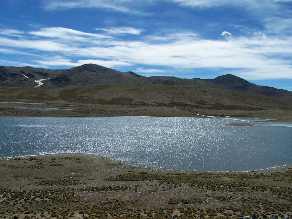
Figure caption: Highest summit in Abra del Acay GLORIA site, Salta (5060 msnm), inthe background Nevado del Acay and Cerro San Miguel. Year 2015