PAPER
Open Dumps in Tucumán: A Remote Approach
In response to the global challenge of urban solid waste management, we present two studies that demonstrate how the combined use of satellite imagery and unmanned aerial vehicles (drones) allows for the detection, mapping, and analysis of the dynamics of open dumps in Tucumán, Argentina.
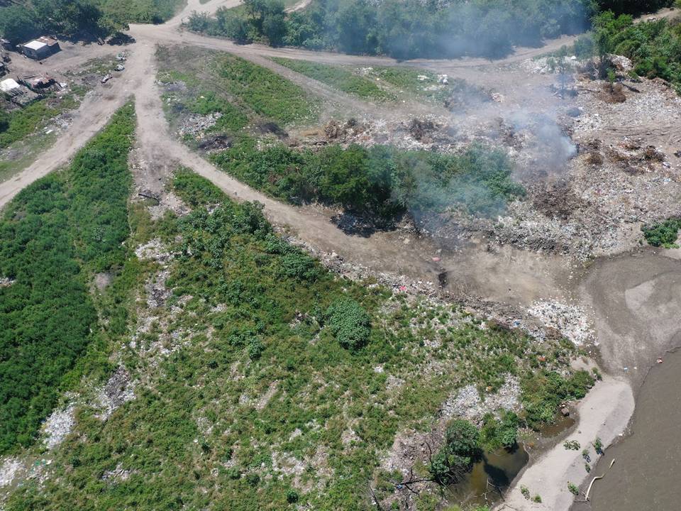
In Malizia et al. (2025), we characterized the situation of these sites in Tucumán by combining satellite imagery and drones. We identified and mapped 40 open dumps near urban centers, within endorheic basins. Furthermore, we observed an increase in their size over the last decade, especially in larger dumps. The average amount of waste was 5,700 tons, although the variation per dumpsite was wide (60 to 35,000 tons). Finally, hydrological analysis allowed us to describe the dynamics of material movements from dumps to surrounding watersheds and crops.
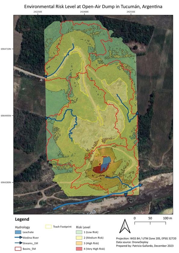
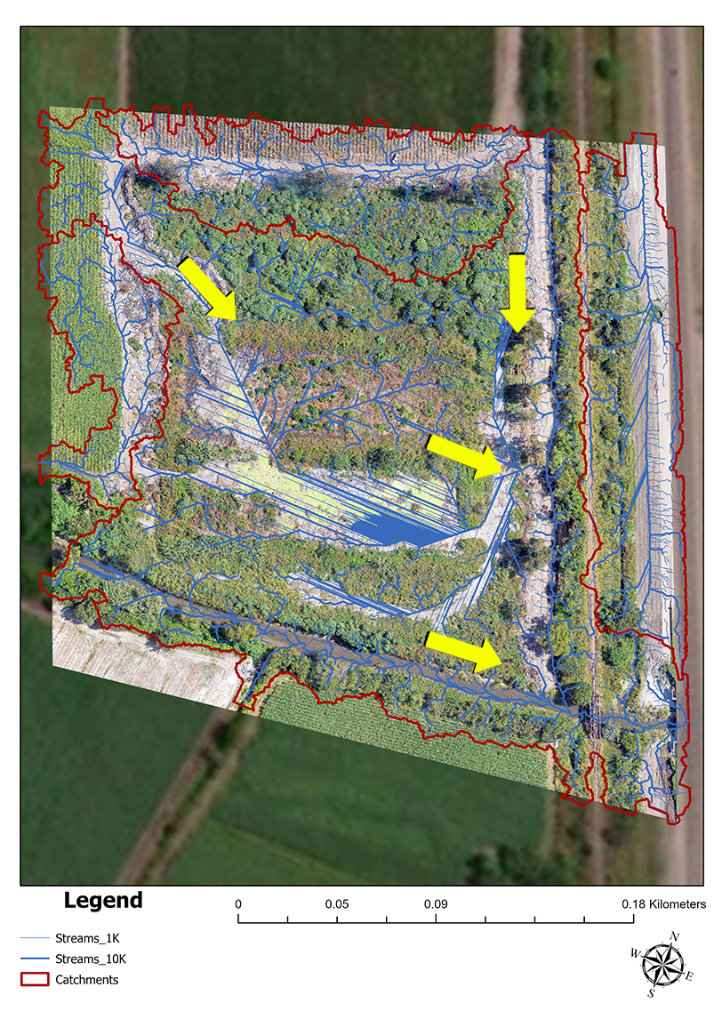
In addition, the work of Gallardo García Freire et al. (2025) enriches this perspective by developing an innovative methodology to assess the potential dispersion of materials in sub-basins. In this study, we integrated drone data with geographic information systems and developed zoned risk maps.These studies provide a baseline for environmental management using a low-cost, high-resolution methodology that can be replicated in other regions.
Malizia A, Galindo-Cardona A, Matias E, Gallardo García Freire P, Foguet J, Monmany-Garzia AC. 2025. Mapping open dumps and waste dynamics in a subtropical ecoregion of Argentina. Scientific Reports 15: 17981. https://doi.org/10.1038/s41598-025-02653-0
Gallardo García Freire P, Matías E, Malizia A, Monmany-Garzia AC, Galindo-Cardona A. 2025. Pollution risk assessment in sub-basins of an open dump using drones and geographic information systems. Waste Management and Research (en prensa). https://doi.org/10.1177/0734242X251314180